Periglacial Process
Imagine you are standing in a vast, open landscape where the ground beneath your feet is frozen solid for most of the year. There is no thick layer of ice or a glacier covering the surface, yet the land remains in a state of deep freeze. This is the periglacial environment, a realm shaped by the relentless battle between freezing and thawing.
What is freezing and thawing?
Freezing ❄️
- Freezing happens when temperatures drop below 0°C, causing water in the soil and ground to turn into ice.
- As water freezes, it expands, pushing the soil and rocks apart.
- This leads to the formation of ice wedges, frost heaving, and permafrost (permanently frozen ground).
Thawing 🌡️
- Thawing occurs when temperatures rise above 0°C, causing ice in the ground to melt.
- The melting ice makes the ground soft and unstable, leading to subsidence (sinking ground), solifluction (slow soil movement), and thermokarst (uneven terrain with depressions and mounds).
In simple terms:
- Freezing = Water in soil turns to ice → Ground expands & cracks.
- Thawing = Ice melts → Ground weakens & sinks.
What is a Periglacial Region?
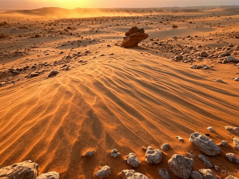
The term periglacial comes from peri (meaning “around”) and glacial (meaning “related to ice”), indicating that these regions exist on the fringes of glacial environments. They are permanently frozen, yet they lack a thick ice sheet covering the ground. You can think of these places as frozen deserts, where the temperatures are harsh, and the land endures a continuous cycle of freezing and thawing.
The Climate of Periglacial Regions
The periglacial climate is defined by extreme cold:
- Temperature: The annual average temperature ranges between -1°C to -15°C, meaning it remains bitterly cold throughout the year.
- Precipitation: Though cold, these areas receive anywhere between 120 mm to 1400 mm of precipitation annually, mostly in the form of snow.
The Structure of Periglacial Land
In these frozen landscapes, the ground is divided into two layers:
- Permafrost: This is the permanently frozen subsoil that never thaws, no matter how warm the summer gets. It acts like a rock-hard foundation beneath the surface.
- Active Layer: This is the topsoil that freezes in winter and thaws in summer. Its depth can vary from a few centimeters to 3 meters, depending on the local climate.
The active layer is where most periglacial processes occur, driven by the constant cycle of freezing and thawing.
What Drives Periglacial Processes?
The primary force behind these processes is temperature fluctuations—both seasonal and daily changes in temperature. The freeze-thaw cycle controls everything, shaping the land in unique ways.
Mechanism of Periglacial Processes
To truly understand how periglacial landscapes evolve, imagine a battle between ice and rock, where the freezing and thawing of water work tirelessly to shape the land. Unlike glaciers, which bulldoze landscapes with sheer mass, periglacial processes operate subtly but relentlessly, breaking, shifting, and shaping the land over time. Let’s explore these key processes in detail.
1. Congelifraction
Think of a crack in a rock, filled with water during the day. As night falls, the water freezes, expands, and pushes against the rock walls. When day returns, the ice melts, and the cycle repeats. Over time, this repeated expansion and contraction causes the rock to shatter into fragments—a process known as Congelifraction, or more simply, frost weathering. So congelifraction may be defined as follows:
Congelifraction is the process of rock disintegration caused by repeated freeze-thaw cycles in periglacial climates
🔹 Key Features:
- Dominated by freeze-thaw cycles in the active layer.
- Occurs mostly in periglacial climates where temperature fluctuations happen daily (diurnal cycle).
- Eventually, large rocks break into smaller pieces, contributing to the landscape’s rocky debris.
2. Frost Heaving
Imagine placing a bottle of water in the freezer—the liquid expands as it turns into ice. Now, picture the same happening in the soil. When water within the ground freezes, it expands by about 9-10%, creating pressure that lifts soil particles and rocks upwards. This process, called Frost Heaving, is what causes stones to mysteriously appear on the surface over time—almost as if the earth is vomiting them out!
🔹 Mechanism of Frost Heaving:
- Vertical Pressure: Ice formation pushes the soil and rocks straight up.
- Lateral Pressure: Expanding ice moves sideways, distorting the ground’s surface.
- Over time, the coarser material (like rocks and pebbles) gets pushed upwards, while finer particles remain deeper underground.
Forst heaving may be defined as follows:
Forst heaving is the upward displacement of soil and rocks due to the expansion of freezing water within the ground, creating vertical and lateral pressure.
3. Congelifluction
During summer, when the top layer of the permafrost (active layer) thaws, it turns into a waterlogged, unstable mass. But since the underlying permafrost remains solid, the thawed soil has no way to drain, causing it to slowly creep downhill under the pull of gravity. This process is known as Congelifluction. Let’s define it:
Congelifluction is the slow downslope movement of water-saturated soil over impermeable permafrost due to seasonal thawing and gravity.
🔹 Key Terms:
- Solifluction (J.G. Anderson): A broader term for the slow movement of waterlogged soil.
- Congelifluction (used in periglacial conditions): When the underlying permafrost prevents proper drainage, causing saturated soil to ooze downslope.
- Cryoturbation (K. Bryan): A more general term for all forms of frost-related soil movement.
- Gelifluction: A modern term replacing Congelifluction.
This process smoothens slopes over time and creates flowing soil formations seen in periglacial regions.
4. Nivation
Ever noticed how snow lingers longer in depressions and shaded areas? This small, protected snow patch becomes a landscaping tool, triggering a set of processes called Nivation.
🔹 How Nivation Works:
- Snow accumulation: Snow collects in hollows, especially on north-facing slopes (in the Northern Hemisphere), where it’s shielded from the sun.
- Compaction: Over time, repeated melting and refreezing turn the snow into névé (granular ice).
- Rock weakening: Freeze-thaw action weakens the underlying bedrock.
- Erosion: Meltwater washes away loosened particles, deepening the hollow.
- Further enlargement: Over centuries, these Nivation hollows can deepen and evolve into cirques or corrie glaciers.
So finally, Nivation may be defined as:
Nivation is the process of landscape erosion caused by persistent snow patches, involving freeze-thaw weathering, compaction, and meltwater erosion, leading to the formation and deepening of hollows.
5. Fluvial Processes
Unlike tropical rivers that carve out deep valleys, streams in periglacial zones struggle to be active agents of erosion. Why? Because they are seasonal and sluggish, controlled entirely by temperature fluctuations.
🔹 Why Periglacial Streams Are Weak:
- They only flow during short summer periods.
- They carry large amounts of sediment from solifluction, making them sluggish.
- Instead of deeply eroding landscapes, they deposit more than they erode.
Thus, while rivers elsewhere shape landscapes aggressively, periglacial streams are mere assistants, not the main sculptors.
6. Aeolian Processes
As periglacial landscapes age, they undergo a final transformation by wind action. In the later stages of periglacial evolution, when slopes become gentle and fine particles dominate, the wind takes over as the primary force of erosion.
🔹 Wind Action in Periglacial Regions:
- Deflation: Loose particles are lifted and carried away.
- Abrasion: Wind-driven sand blasts rock surfaces, shaping them.
- Deposition: Fine dust settles elsewhere, forming features like loess deposits.
In short, wind completes the periglacial cycle by sculpting the remaining debris into new landforms.
Conclusion
Periglacial regions may appear lifeless and static, but beneath the surface, a delicate dance of freezing, thawing, and movement is constantly reshaping the land. From rock-shattering frost to slow-moving soil flows, from hidden snow hollows to creeping ice lenses, these processes work silently over thousands of years to create some of Earth’s most unique landscapes.
Sample Question
Q. Explain the processes of freezing and thawing in periglacial environments and their role in shaping periglacial landforms. How do these processes contribute to geomorphological hazards in cold regions? (250 words)
Answer:
Introduction:
Periglacial environments are cold-climate regions where freezing and thawing cycles dominate landform development. These processes play a crucial role in shaping the landscape and influencing geomorphological hazards.
Freezing Process:
- When temperatures drop below 0°C, water within soil and rock freezes, expanding by about 9% in volume.
- This causes frost heaving, where ice lenses grow, pushing the ground upward.
- Ice wedges form as repeated freeze-thaw cycles create deep cracks filled with ice.
Thawing Process:
- As temperatures rise, frozen ground melts, leading to subsidence and solifluction—the downslope movement of water-saturated soil.
- Thermokarst features, such as sinkholes and uneven terrain, form due to ice wedge melting.
- Seasonal thawing of active layers above permafrost results in irregular drainage patterns and ground instability.
Impact on Periglacial Landforms:
- Frost polygons, pingos (ice-cored mounds), and patterned ground emerge due to differential freezing and thawing.
- Solifluction lobes and thermokarst lakes develop due to thawing-induced sediment movement.
Geomorphological Hazards:
- Infrastructure damage: Thawing permafrost weakens foundations, causing road and building collapse (e.g., Siberia, Alaska).
- Slope failures and landslides: Unstable, thawing ground increases landslide risk.
- Carbon release: Thawing permafrost releases greenhouse gases, accelerating climate change.
Conclusion:
Freezing and thawing processes in periglacial regions are vital for landscape evolution but also pose significant hazards, requiring sustainable adaptation strategies.


