Mountain Ranges of North America
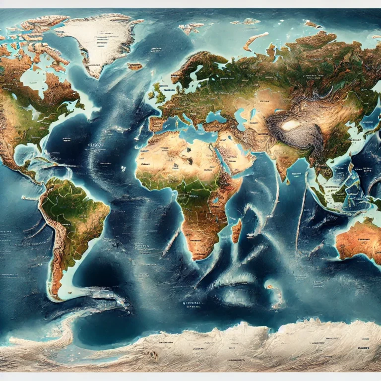
When we look at a continent from a geographer’s perspective, mountains are not just elevations on the map. They are tectonic biographies — written over millions of years, shaped by internal forces and external agents. Mountains control climate, rivers, settlement patterns, vegetation, and even culture. Look at the diagram of the mountain ranges marked on physical map of North America and try to analyse them.

Appalachian Mountains – The Ancient Sentinels of the East
Appalachian Mountains — a system that has witnessed the breakup of Pangaea and has stood the test of erosion for hundreds of millions of years.
🔍 Key Features:
- Length: Approx. 3,200 km, stretching from Newfoundland and Labrador (Canada) to central Alabama (USA).
- It acts as a natural divide between:
- The Eastern Coastal Plain (towards the Atlantic Ocean)
- And the Interior Lowlands (towards the Mississippi basin)
🏞️ Geographical Significance:
- These mountains are among the oldest on Earth, originally formed during ancient tectonic collisions (including the Caledonian and Hercynian orogenies).
- Over millions of years, these high mountains have been heavily eroded, making them lower in elevation but rich in sedimentary formations and coal deposits.
- The highest point is Mount Mitchell in North Carolina — 2,037 meters above sea level.
🌊 River Networks & Valleys:
- A fascinating network of rivers, streams, and waterfalls criss-crosses the region, contributing to rich biodiversity and scenic beauty.
- A major physiographic feature is the Great Appalachian Valley, which includes:
- The St. Lawrence River Valley (Canada)
- The Tennessee Valley (USA)
This valley has historically served as a migration route, a transport corridor, and a cultural zone.
🧩 Divisions of the Appalachian System:
- Northern Appalachia – Canada and northeastern USA
- Central Appalachia – Includes the Allegheny Mountains
- Southern Appalachia – Includes parts of Tennessee, North Carolina, and Alabama
💡 Think of the Appalachians not as a single ridge, but as a family of mountains — each range a sibling with its own geological story.
North American Cordillera – The Western Wall of the Continent
Now let’s move west — where the land rises again, but this time in a more aggressive and youthful expression of tectonics. This is the North American Cordillera — a vast system of interconnected mountain chains formed by active plate boundaries.
🌍 What is a “Cordillera”?
The term Cordillera comes from Spanish, meaning a “chain of mountains” — and that’s exactly what this system is: a series of parallel and branching ranges, stretching from Alaska in the north to Central America, and eventually merging with the Andes of South America.
🔗 Major Components (North to South):
- Alaska Range
- Brooks Range
- Mackenzie Mountains
- Coast Mountains
- Rocky Mountains
- Sierra Nevada
- Sierra Madre (Mexico)
🧭 Observation: This is not a single line, but a belt of ranges, interspersed with plateaus, basins, and valleys, such as:
- The Great Basin
- The Columbia Plateau
- The Colorado Plateau
🏔️ Physiographic and Geological Importance:
- The western Cordillera includes the highest mountains in this system.
- Unlike the Appalachians, the Cordillera is tectonically active — with earthquakes, volcanoes, and frequent uplift.
- This is due to the interaction of the North American Plate with the Pacific Plate — especially along the San Andreas Fault and related subduction zones.
🔥 From Alaska to Andes:
- One of the most remarkable facts is that the North American Cordillera is geologically connected to the Andes — forming part of the larger American Cordillera, which is the longest mountain chain in the world.
The Rocky Mountains – The Cordilleran Backbone of North America
If the North American Cordillera is like a giant skeletal structure running along the western edge of the continent, then the Rocky Mountains are its spinal column — strong, central, and defining 😊
These aren’t just a series of peaks; they are a geological monument — formed through millions of years of tectonic drama and sculpted by glaciers, rivers, and time.
📍 Location and Extent:
- The Rockies extend approximately 4,800 km.
- From northern Alberta and British Columbia in Canada to New Mexico in the United States.
- They form the easternmost and central feature of the North American Cordillera.
🧭 Mnemonic to remember their span:
“From the Glaciers of Alberta to the Deserts of New Mexico.”
🛠️ Geological Formation:
- The Rockies were primarily formed during the Laramide Orogeny — a period of intense mountain-building tectonic activity between 80 to 55 million years ago.
- Later, this rugged terrain was further shaped by:
- Erosional forces (wind, rivers)
- Glacial activity from the Pleistocene and Holocene Epochs
Thus, the present landscape is a mosaic of tectonic uplift, glacial carving, and erosional smoothing.
🏞️ Geographical Neighbours:
- To the east: The Great Plains – flat, fertile, and agriculturally important.
- To the west:
- Interior Plateau
- Coast Mountains
- Columbia Plateau
- Basin and Range Province
This positioning gives the Rockies a central role in climatic, ecological, and hydrological systems of western North America.
🏔️ Highest Peak:
- Mount Elbert (in the Sawatch Range, Colorado)
- Height: ~4,401 meters
- It is the tallest peak in the Rocky Mountains.
🧭 Physiographic Divisions of the Rockies:
The Rocky Mountains are not a monolithic chain. They consist of over 100 distinct ranges, broadly grouped into four major subdivisions:
1️⃣ Canadian Rockies:
- Located in Alberta and British Columbia, and extending into Yukon and Northwest Territories.
- Includes mountain systems like the Mackenzie Mountains and Selwyn Mountains.
- Acts as a natural boundary between Alberta (prairies) and British Columbia (coastal mountains).
2️⃣ Middle Rockies:
- Found in parts of Wyoming, Montana, and Idaho.
- Known for high glaciated peaks and deep valleys.
- Glaciers still persist in some areas, especially in Yellowstone and Grand Teton regions.
3️⃣ Southern Rockies:
- Located primarily in Colorado, New Mexico, and parts of Utah.
- Contains higher ranges and intermontane basins, like:
- Arkansas River Basin
- San Luis Valley
- Home to Mount Elbert, the highest peak in the entire system.
4️⃣ Colorado Plateau:
- Though not a “mountain range” in the traditional sense, this region is geologically linked to the Rockies.
- Located in the Four Corners region — where Utah, Colorado, New Mexico, and Arizona meet.
- Known for:
- High elevation
- Deep canyons (e.g., Grand Canyon)
- Stunning rock formations (e.g., Monument Valley)
💡 Think of the Colorado Plateau as the tabletop resting beside the rugged spines of the Rockies.
🌊 Hydrological Importance – The Continental Divide
One of the most significant features of the Rockies is the Western Continental Divide.
- It runs along the crests of the Rocky Mountains — from northwestern Canada through the USA.
- It serves as a hydrological boundary:
- Rivers on the west flow into the Pacific Ocean.
- Rivers on the east drain into the Atlantic Ocean or Arctic Ocean.
🧭 Interesting Fact:
In Glacier National Park, in the Lewis Range, there’s a peak called Triple Divide Peak. Here, water can flow into three different basins:
- The Pacific Ocean
- The Atlantic Ocean
- The Hudson Bay (Arctic basin)
This makes it a unique hydrological point on Earth.

Alaskan Mountains – The Frozen Sentinels of the North
Located in the northwestern extremity of North America, primarily in the U.S. state of Alaska, these mountain systems are geologically active, climatically extreme, and scenically breathtaking.
The Alaskan Mountains can be divided into three principal groups:
a) Brooks Range and Arctic Foothills
- Location: Extends in an east–west arc from the Canadian border across northern Alaska.
- Function: Forms a drainage divide between:
- Rivers flowing into the Arctic Ocean and Kotzebue Sound
- Rivers draining into the Yukon River system
- The entire region is heavily glaciated, resulting in:
- Rugged terrain
- Sharp ridges and U-shaped valleys
b) Central Alaskan Highlands and River Basins
- Dominated by highlands and basins, this region is dissected by rivers like:
- Yukon River
- Kuskokwim River
- Climatically, it resembles a colder, wetter version of the Great Basin.
- Divided into:
- Eastern Highlands
- Western Highlands
- Seward Peninsula
c) Southern Alaskan Ranges
These include the Alaska Range and the Aleutian Range:
- Alaska Range:
- Home to Denali (formerly Mount McKinley), the tallest peak in North America at 6,190 meters.
- Acts as a drainage divide between:
- Yukon River (inland)
- Gulf of Alaska (seaward)
- Aleutian Range:
- A volcanic arc with over 80 volcanoes
- Site of the 1912 eruption that created the Valley of Ten Thousand Smokes
💡 Why important?
The Aleutians and the Alaska Range lie in the Ring of Fire, a zone of frequent volcanic activity around the Pacific Ocean.
d) Gulf of Alaska and the Southeastern Panhandle
- Mountainous belt from Kodiak Island to Baranof Island
- Includes:
- Kenai Mountains
- Chugach Mountains
- Features:
- Heavily glaciated terrain
- Steep coastal ranges that act as a barrier along the Pacific
📍 Panhandle:
The Alaska Panhandle is a narrow strip of land stretching southeast from Alaska.
Pacific Mountain System
This system hugs the Pacific Coast from northern British Columbia in Canada to northwestern Mexico.
From North to South:
- Coast Mountains (British Columbia)
- Vancouver Island and Queen Charlotte Islands
- Olympic Mountains (Washington)
- Cascade Range (Washington to Northern California)
- Coast Ranges (Oregon and California)
- Klamath Mountains (Northern California)
- Transverse Ranges (Southern California)
- Sierra Nevada (Eastern California — sometimes considered part of this system)
Note: Don’t confuse Washington State with Washington, D.C., the capital of the United States. In the context above, we’re referring to Washington State, which is located in the Pacific Northwest on the West Coast. In contrast, Washington, D.C. is a separate entity located on the East Coast. For clarity, I’ve included a map of the U.S. from Wikipedia below, where you can see Washington State in the western region and Washington, D.C. marked with a red dot in the east.

Cascade Mountain System
- Extends from Northern California through Oregon, Washington, into British Columbia.
- Geologically volcanic, formed by the Cascadia Subduction Zone:
- The Juan de Fuca Plate subducts beneath the North American Plate
- Magma rises, forming volcanic peaks
🧠 Volcanoes in the Cascade Range include:
- Mount St. Helens
- Mount Rainier
- Mount Hood
💥 Part of the Pacific Ring of Fire — the most volcanically active region on Earth.
Yellowstone Caldera – A Sleeping Supervolcano
- Located in Yellowstone National Park, Wyoming
- Formed by three major volcanic eruptions:
- ~2.1 million years ago
- ~1.3 million years ago
- ~640,000 years ago – formed the present Yellowstone Caldera
🌋 It is one of Earth’s supervolcanoes, capable of producing eruptions of magnitude 8.
- Known for:
- Old Faithful Geyser
- Geothermal hot springs
- Rich wildlife and scenic beauty
Sierra Nevada
- Extends 400 km along California’s eastern edge, from the Mojave Desert to the Cascade Range.
- Acts as a natural divide between:
- The Central Valley (to the west)
- The Basin and Range Province (to the east)
Features:
- An asymmetrical mountain range, caused by faulting:
- Steep eastern slope
- Gentler western slope
- Mount Whitney (4,421 m) — the highest peak in the contiguous United States
🧭 Why Asymmetrical?
Due to tilting along a central fault zone, which lifted one side more steeply.
Summary Table
| Mountain System | Location | Key Features | Highest Peak | Geological Aspects |
| Appalachian Mountains | Eastern North America (Newfoundland to Alabama) | Oldest mountains; highly eroded; rich in coal and sedimentary deposits; Great Appalachian Valley; natural divide between Coastal Plain and Interior Lowlands | Mount Mitchell (2,037 m) | Formed by ancient orogenies (Caledonian & Hercynian); heavily eroded over time |
| North American Cordillera | Western North America (Alaska to Central America) | A vast system of interlinked ranges; includes Rocky Mts., Sierra Nevada, Cascades, etc.; tectonically active with volcanoes and earthquakes | Mount Denali (6,190 m) | Formed due to Pacific and North American plate interactions; includes subduction zones and transform faults |
| Rocky Mountains | From Alberta (Canada) to New Mexico (USA) | Backbone of North American Cordillera; includes Canadian, Middle, Southern Rockies, and Colorado Plateau; Continental Divide present here | Mount Elbert (4,401 m) | Formed during Laramide Orogeny; shaped by glaciation and erosion |
| Alaskan Mountains | Northern and central Alaska | Includes Brooks Range, Alaska Range, Aleutians; volcanic & glaciated; part of Ring of Fire; drainage divides for Arctic & Pacific systems | Denali (Mount McKinley) – 6,190 m | Tectonically active; part of Pacific Ring of Fire; includes volcanic arcs like the Aleutians |
| Pacific Mountain System | Pacific Coast (British Columbia to NW Mexico) | Includes Coast Mountains, Sierra Nevada, Cascades, Klamath, and Transverse Ranges; heavily influenced by faulting and volcanism | Mount Whitney (4,421 m) | Volcanic and fault-block origins; Sierra Nevada formed by tilting and uplift |
| Cascade Range | Northern California to British Columbia | Volcanic mountains due to Cascadia subduction; home to active volcanoes like Mount St. Helens, Rainier, and Hood | Mount Rainier (4,392 m) | Subduction of Juan de Fuca Plate under North American Plate |
| Sierra Nevada | Eastern California (400 km range) | Asymmetrical fault-block mountains; steep east, gentle west; separates Central Valley from Basin & Range Province | Mount Whitney (4,421 m) | Formed by faulting and tilting; young and steeply uplifted on eastern edge |
| Brooks Range | Northern Alaska | Part of Arctic drainage divide; heavily glaciated; includes rugged peaks and U-shaped valleys | – | Glacially carved terrain; part of Alaskan mountain chain |
| Colorado Plateau | Four Corners Region (UT, AZ, NM, CO) | Not a true range; high plateau with deep canyons; Grand Canyon lies here | – | Linked to the Rockies; shaped by uplift and river erosion (esp. Colorado River) |
| Yellowstone Caldera | Wyoming (Yellowstone National Park) | Supervolcano; site of massive eruptions; geothermal features like geysers and hot springs | – | Formed by hotspot volcanism; caldera created by series of massive eruptions |


