
Political map of Asia
Asia is not just the largest continent in terms of area and population; it is also the most geopolitically complex. Asia’s borders are shaped by a mix of indigenous civilizations, colonial legacies, Cold War dynamics, and ongoing disputes.
🕰️ Historical Legacy and Colonial Influence
- West Asia (Middle East) is the cradle of early civilizations (Mesopotamia, Persia) but later saw the Ottoman Empire’s dominance. Colonial mandates post-WWI led to unnatural borders (e.g., Sykes-Picot Agreement).
- South Asia was largely shaped by British colonialism. India, Pakistan, Bangladesh emerged from one colonial state—British India—through partition.
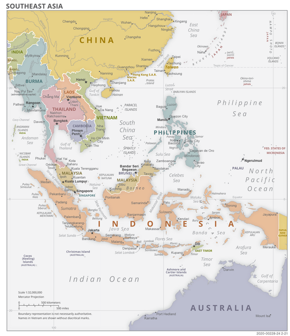
- Southeast Asia shows diverse colonial legacies:
- Indonesia – Dutch
- Vietnam, Cambodia, Laos – French
- Myanmar, Malaysia – British
- Philippines – Spanish, later American
- Central Asia and Mongolia were under the Soviet sphere, with borders drawn for political convenience, not ethnic coherence.
🧠 UPSC Tip: Always link colonial borders to post-colonial conflicts—e.g., India-Pakistan (Kashmir), Israel-Palestine, Afghanistan’s Durand Line.
🌏 Major Geopolitical Regions of Asia
To make memorization easier, divide Asia into six geopolitical regions, each with unique traits:
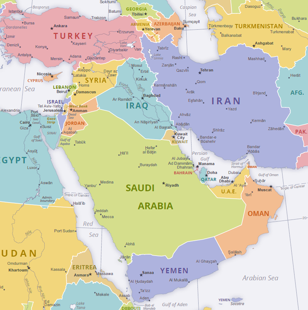
a) West Asia (Middle East)
📍 Countries: Saudi Arabia, Iran, Iraq, Syria, Turkey, Israel, Jordan, Yemen, UAE, etc.
🔍 Key Themes:
- Oil diplomacy (OPEC)
- Sectarian divide (Sunni-Saudi vs Shia-Iran)
- Arab-Israel Conflict (Israel–Palestine)
- War-torn zones: Syria, Yemen, Iraq
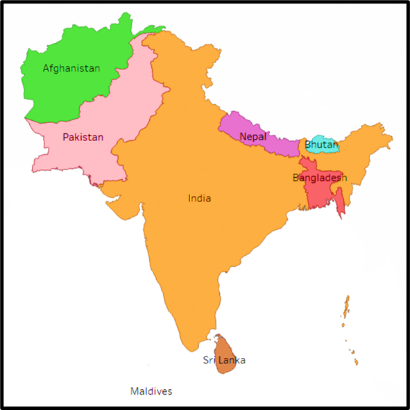
b) South Asia
📍 Countries: India, Pakistan, Bangladesh, Nepal, Bhutan, Sri Lanka, Maldives, Afghanistan
🔍 Key Themes:
- High population and density
- India-Pakistan-China triangle (Kashmir, PoK, Aksai Chin)
- SAARC regional grouping
- Himalayas as a natural boundary
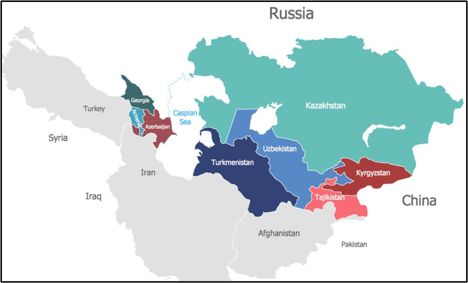
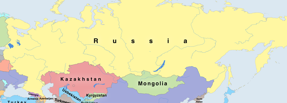
c) Central Asia
📍 Countries: Kazakhstan, Uzbekistan, Turkmenistan, Kyrgyzstan, Tajikistan
🔍 Key Themes:
- Former Soviet Republics
- Rich in energy but landlocked
- Geopolitical crossroads (Russia–China–Middle East)
- Silk Route legacy
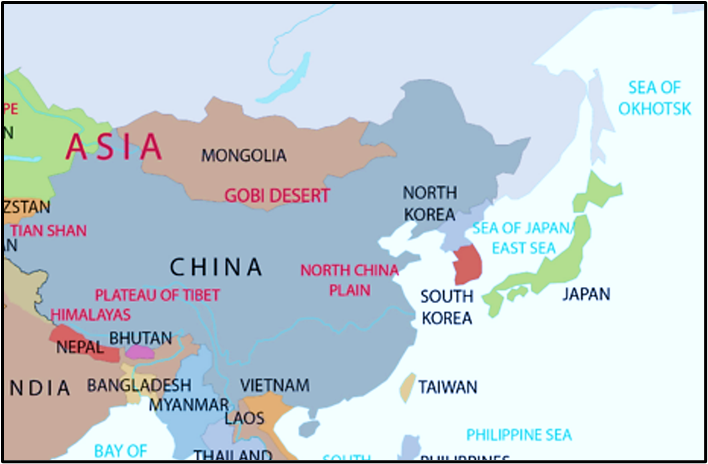
d) East Asia
📍 Countries: China, Japan, North Korea, South Korea, Taiwan, Mongolia
🔍 Key Themes:
- China as an emerging superpower
- Taiwan issue (One-China Policy)
- Korean Peninsula tension (North vs South Korea)
- Japan – pacifist constitution, but regional military relevance
e) Southeast Asia
📍 Countries: Indonesia, Malaysia, Singapore, Thailand, Vietnam, Myanmar, Philippines, etc.
🔍 Key Themes:
- ASEAN grouping
- South China Sea dispute (China vs ASEAN)
- Maritime chokepoints – Strait of Malacca
- Diverse religions and colonial pasts
f) North Asia
📍 Only one country dominates: Russia (Asian part)
🔍 Key Themes:
- Siberia – resource-rich but sparsely populated
- Strategic depth of Russia from Europe to Pacific
🚩 Conflict Zones and Disputed Borders
Asia has many flashpoints—some frozen, some active. Knowing these is a must for both World Mapping and International Relations.
- India–Pakistan: Kashmir dispute (LoC, PoK, Aksai Chin)
- India–China: LAC conflicts (Galwan, Doklam, Arunachal)
- Israel–Palestine: Gaza, West Bank, Jerusalem issue
- China–Taiwan: Unification vs independence
- South China Sea: Spratly, Paracel islands dispute (China vs Vietnam, Philippines, Malaysia)
- Korea: Armistice, not peace; DMZ still active
- Nagorno-Karabakh: Armenia–Azerbaijan conflict
🧠 UPSC Tip: Use maps to track disputed areas. These are also relevant for IR, Security, and Current Affairs.
🧭 Political Groupings and Alliances
Political geography is not just about physical borders, but also political alliances:
- ASEAN: 10 Southeast Asian nations – economic and strategic bloc.
- SCO (Shanghai Cooperation Organisation): India, China, Russia, Central Asian nations.
- SAARC: South Asian Association – dormant due to Indo-Pak tensions.
- OIC: Organisation of Islamic Cooperation – includes many West and South Asian countries.
- QUAD: India, USA, Japan, Australia – countering China’s influence.
- Belt and Road Initiative (BRI): China-led infrastructure connectivity across Asia.
📌 UPSC Takeaway: Geopolitical alignments influence strategic mapping. Example: Chabahar vs Gwadar ports in Iran–Pakistan–India–China game.
🌍 Regional Memory Tools – Smart Mapping Strategy
Let’s apply some tricks to remember Asia’s map more effectively:
a) Think in Clusters:
- Stans = Central Asia (Kazakhstan, Kyrgyzstan…)
- Little Dragons = East Asia (Japan, South Korea, Taiwan, Hong Kong)
- Maritime Asia = ASEAN nations
- SAARC = South Asia
b) Natural Boundaries:
- Himalayas = South Asia vs East Asia
- Zagros Mountains = Iran–Iraq
- Gobi Desert = Mongolia–China
- Ural Mountains = Europe–Asia divide (within Russia)
c) Conflict-Based Recall:
- Kashmir = Tri-junction of India–Pakistan–China
- Taiwan = Flashpoint in China–US rivalry
- Gaza Strip = Israel–Palestine focus
- Spratly Islands = China–ASEAN tension
d) Chronological Tracing:
- 1947: India–Pakistan Partition
- 1948: Israel founded
- 1971: Bangladesh Liberation
- 1991: USSR collapse → 5 Central Asian republics emerge
🔍 In Summary
| Region | Key Traits | Strategic Highlight |
| West Asia | Oil, religion, conflict | Middle East politics, OPEC, Israel issue |
| South Asia | Populous, post-colonial, SAARC | India–China–Pakistan triangle |
| Central Asia | Ex-Soviet, energy rich, landlocked | SCO, Silk Road, Eurasian bridge |
| East Asia | Economic giants, authoritarian regimes | China–Taiwan, Korean DMZ, tech powerhouses |
| Southeast Asia | Maritime, ASEAN, diverse | South China Sea, Malacca Strait |
| North Asia | Only Russia – sparsely populated yet vast | Arctic routes, Russian strategic buffer |
One Comment