Indian Climate
Introduction
Let us begin with a simple observation.
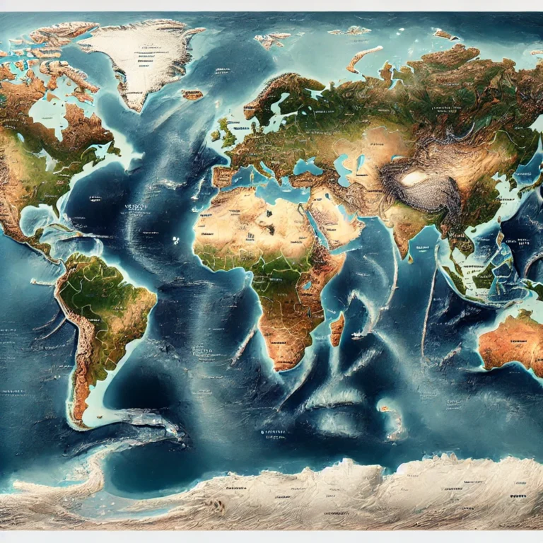
If you look at India on the world map, you’ll notice that the country lies broadly between 8°N and 37°N latitudes. This means that India stretches from the tropical zone into the temperate zone. So technically, one would expect that the southern part of India should have a tropical climate, and the northern part, lying above the Tropic of Cancer, should experience a temperate climate.
But here comes the interesting twist.
The Himalayan Shield
Imagine you’re inside a room in winter, and the room has no windows or insulation. Cold air easily seeps in, right? Now, think of the Himalayas as a thick insulating wall at the northern boundary of India. These lofty mountains block the icy-cold winds coming from Central Asia, especially in the winter.
Because of this natural barrier, North India remains warmer by about 3°C to 8°C compared to other regions on the same latitude—places which should have similar temperatures if there were no Himalayas.
Summer and the Sun: Tropical Heat All Around
In summers, the Sun is almost directly overhead in most of India, especially in the southern parts. This results in a very intense heat, especially in the Deccan Plateau and peninsular India, making it resemble an equatorial dry climate—hot and relatively dry.
But what about the north?
Even the north Indian plains become blisteringly hot. This is because of the ‘loo’ winds—hot, dry winds that blow from the Thar Desert, Balochistan, and even Iranian deserts. These winds push temperatures up to extreme levels in the northern plains, making them as hot as the southern regions during summer.
So, Is All of India Tropical?
Technically, no—because the northern part lies in the temperate zone.
But climatically, yes—and here’s why:
- The Himalayas block the temperate influences.
- The summer heat makes even northern India behave like a tropical region.
- The entire subcontinent, south of the Himalayas, experiences uniform heat patterns.
So, geographers treat India climatically as a tropical country.
The Defining Feature: Tropical Monsoon Climate
Now comes the hallmark of Indian climate—the monsoon.
India’s climate is not just tropical, but specifically a tropical monsoon type. This means:
- There is a distinct wet season (roughly June to September).
- Followed by a dry season (rest of the year).
- The winds reverse direction seasonally—a phenomenon known as the monsoonal reversal.
- In summer, winds come from the ocean (southwest monsoon)—bringing rain.
- In winter, winds come from the land (northeast monsoon)—mostly dry.
This seasonal wind reversal happens due to the differential heating of land and sea, and it defines the agricultural calendar, the ecosystem, and even the culture of India.
✅ Conclusion
So to sum up upto now: “Though geographically, India stretches from the tropics into the temperate zone, its climatic character—thanks to the Himalayas and the monsoon system—makes it behave like a tropical monsoon country. It’s neither fully tropical nor temperate—it’s a unique blend, but best defined as tropical monsoon climate.”
🌦️ Features of Indian Climate
India’s climate is as diverse as its culture—and for good reason. The country stretches across thousands of kilometers from north to south and east to west, encompassing mountains, plateaus, plains, deserts, and coasts. Each of these topographical features influences the climate in its own unique way.
Let’s understand these features by breaking them down into two major components:
- Rainfall
- Temperature
☔ Rainfall Patterns: From Torrential to Barely a Drizzle
🔹 Seasonal Rhythm
In most parts of India, the year is sharply divided into wet and dry seasons—this is a signature of the tropical monsoon climate.
However, this rule doesn’t apply uniformly across the country.
👉 For instance, Thar Desert in Rajasthan and Ladakh in the north don’t really have a wet season at all. These regions remain dry most of the year, with rainfall being scarce or almost negligible.
🔹 Staggering Variation in Rainfall
The range of annual rainfall in India is one of the widest in the world.
- On one end, we have Mawsynram and Cherrapunji in Meghalaya—receiving over 1,100 cm of rain annually. These are among the wettest places on Earth.
- On the opposite end, places like Jaisalmer in Rajasthan get less than 12 cm per year—almost desert-like.
✅ This contrast illustrates the role of relief and windward-leeward orientation.
🔹 Timing of the Rains
Not only does rainfall vary in amount, but also in timing.
- Eastern India, especially areas like Goa, Hyderabad, and Patna, typically receives southwest monsoon rains by early June.
- But Northwest India, including parts of Punjab and Rajasthan, might wait till early July.
Now flip to the Coromandel Coast—places like Chennai—and you’ll see an even more curious case.
- While most of India gets rain in July-August, the Tamil Nadu coast is dry in those months.
- Instead, it receives its main rainfall in October-November, from the northeast monsoon.
This clearly shows: Indian rainfall is not just about how much, but also when and where.
🌡️ Temperature: A Country of Contrasts
India’s temperature patterns, like its rainfall, show immense diversity.
🔹 Diurnal and Annual Ranges
- Diurnal range means the difference between day and night temperatures.
- Annual range is the difference between summer and winter temperatures.
Both these ranges vary significantly across regions.
- In the Thar Desert, you might sweat in the scorching sun during the day and then feel a chill at night—because it has the highest diurnal range.
- In contrast, the coastal areas, such as Mumbai or Chennai, have minimal differences between day and night or summer and winter—thanks to the sea’s moderating influence.
🔹 Extreme Temperatures
- In Jammu & Kashmir, especially Ladakh, winter temperatures can plunge to –40°C.
- But on the same winter day, a city like Kochi or Chennai might enjoy a cozy 20–25°C.
Now flip to summer—most parts of India sizzle. Temperatures frequently cross 45°C in central and northern India.
But the Himalayan regions flip this trend again—they have brutally cold winters, but mild summers—because of their altitude.
🌏 Factors Affecting Indian Climate
India’s climate is shaped not by one or two, but by a complex interplay of multiple factors—from its latitude and mountains to global wind systems and ocean currents. Let’s walk through each one step by step, building up the full picture.
1️⃣ Latitudinal Location: Solar Switchboard
India lies between 8°N and 37°N, which means:
- Southern India lies in the tropics → receives direct solar insolation → hotter and more humid.
- Northern India, above the Tropic of Cancer, lies in the warm temperate zone → receives less direct sunlight, but still experiences extremely hot summers due to local factors (like loo winds).
- Winters in the north become very cold, especially with the arrival of western disturbances.
- Coastal areas enjoy equable temperatures, regardless of their latitude, because the sea acts like a thermal buffer.
✅ Key Idea: Latitude gives us a theoretical climate, but actual climate depends on many interacting variables.
2️⃣ Distance from the Sea: The Maritime vs Continental Tug of War
- Coastal regions (like Mumbai or Chennai) have a moderate (equable) climate due to the sea’s regulating effect—cooler summers and warmer winters.
- Interior regions (like Delhi or Nagpur) experience extreme temperatures—scorching summers and chilly winters.
- Also, monsoon winds strike coastal areas first, giving them early and higher rainfall.
3️⃣ The Himalayas: Nature’s Great Wall
The Himalayas are perhaps the most influential physical feature:
- In winter, they block icy winds from Central Asia, keeping most of India warmer than places on similar latitudes.
- In summer, they act as an orographic barrier, forcing southwest monsoon winds to rise → resulting in heavy rainfall on the southern slopes.
- They also split the Bay of Bengal monsoon branch, guiding it into northern India and Southeast Asia.
- Without the Himalayas, monsoon winds would bypass India and north India would likely be a desert.
✅ This is why Punjab and Haryana are fertile, while places at similar latitudes west of India (like Pakistan or Iran) are mostly arid.
4️⃣ Physiography: The Layout of the Land
- Relief and orientation of mountain ranges determines where the rain falls and where it doesn’t.
- Western Ghats: Their windward side (Kerala, coastal Karnataka) gets heavy rainfall.
- Leeward side (like Maharashtra, Telangana) lies in the rain-shadow zone → hence semi-arid.
- Aravalli Range runs parallel to the monsoon winds → fails to cause uplift → no orographic rain in Rajasthan and Gujarat.
✅ Hence, Thar Desert formed due to:
- No orographic barrier
- Parallel wind movement
- Absence of vertical convection
- Presence of Sub-Tropical High Pressure (STJ) during winter
5️⃣ Monsoon Winds: The Heartbeat of Indian Climate
The Southwest Monsoon is the main driver of rainfall in India.
Key features:
- Sudden onset in early June
- Gradual progress northwards
- Seasonal reversal in October (becoming Northeast Monsoon)
- Major rainfall during SW monsoon (except Tamil Nadu, which relies on NE monsoon)
✅ This explains why Chennai gets rain in October-November, while Delhi gets it in July.
6️⃣ Upper Air Circulation: The Jet Stream Story
Jet Streams are fast, high-altitude winds that influence weather patterns:
- Westerly Jet Stream (Winter):
- Brings Western Disturbances from the Mediterranean
- Causes rainfall in NW India, snowfall in Himalayas
- Followed by cold waves in North India
- Easterly Jet Stream (Summer):
- Forms due to heating of the Tibetan Plateau
- Responsible for the sudden onset of the Southwest Monsoon
✅ Jet streams are like invisible steering currents that guide weather systems.
7️⃣ Tropical Cyclones and Western Disturbances: Seasonal Visitors
- Tropical Cyclones:
- Mostly form in the Bay of Bengal (some in Arabian Sea)
- Affect east coast during monsoon and retreating monsoon (Oct-Nov)
- Can cause devastating floods and winds
- Western Disturbances:
- Enter India from Iran and Afghanistan in winter
- Cause rainfall in Punjab, Haryana, Delhi, and snow in Kashmir and Himachal
- Help wheat crops but also bring cold waves
8️⃣ El Niño, La Niña & ENSO
These are global phenomena, but they strongly influence Indian monsoons.
- El Niño:
- Warming of eastern Pacific Ocean
- Suppresses monsoon, increases drought risk in India
- Promotes cyclones in Arabian Sea
- La Niña:
- Cooling of eastern Pacific
- Strengthens monsoon, increases flood risk
- Encourages cyclones in Bay of Bengal
- ENSO (El Niño Southern Oscillation):
- A combined system of ocean warming + pressure changes
- Most El Niño events coincide with ENSO, which alters wind patterns and rainfall globally
✅ In short, even oceans thousands of kilometers away can dictate whether Indian farmers face droughts or floods.
🧠 In Conclusion – A Climatic Symphony
“Indian climate is like a grand orchestra, where mountains, oceans, winds, and even distant Pacific currents play their own instruments. The monsoon may be the lead singer, but every other factor—Himalayas, jet streams, cyclones, El Niño—is a vital part of the performance.
To understand Indian climate, I Recommend you not just memorize these factors, but see how they interact, reinforce, or oppose each other, much like characters in a novel.”


