
Spatial Analysis
Imagine you’re looking at a map—not just to locate places, but to understand the deeper patterns in how those places are arranged and how they affect human life. That, in essence, is Spatial Analysis.
Spatial analysis refers to the quantitative techniques used to study location patterns—how and why different features like cities, industries, or resources are distributed across space.
This is a key part of what is known as locational analysis—a scientific attempt to understand where things happen and why there.
🔍 Unwin’s View: A Map Is a Treasure of Spatial Clues
The geographer Tim Unwin defined spatial analysis as:
“The study of arrangements of points, lines, areas, and surfaces on the map.”
Let’s break this down:
- Points could be cities, industries, airports.
- Lines could be roads, rivers, railways.
- Areas could be agricultural zones or industrial belts.
- Surfaces could refer to terrains—plains, plateaus, hills.
Spatial analysis tries to find out how these elements are organized, related, and how their arrangement influences human activity.
🧬 Roots in Positivism and the Quantitative Revolution
Spatial analysis became popular during the Quantitative Revolution—a time when geographers began to embrace scientific methods, models, and mathematics instead of just descriptive writing.
It is deeply tied to the philosophy of Positivism, which emphasizes:
- Objectivity
- Empirical observation
- Use of mathematical logic
The ultimate goal?
To build generalizations and predictive models—something geography previously struggled with due to its focus on unique regional descriptions.
Relation Between QR Models and Spatial Analysis
You create a model to make sense of spatial analysis.
➡️ For example, Gravity Model helps analyze movement of people, goods, information across space.
Think of it like:
| Spatial Analysis (raw observation) ➡️ Model (structured explanation) ➡️ Predictions |
🧠Real-world Analogy (to make it even clearer):
Think about Google Maps.
- You want to find the best route to reach a destination.
- Google uses tons of real-world data (traffic, distance, time).
- But you don’t see all the chaotic reality on your screen —
➔ You see a Model (simplified version) that highlights only what you need (roads, traffic blocks).
Similarly, geographers create models of cities, transport, population to make the complex world understandable and navigable.
📐 The 3 Core Concepts of Spatial Analysis
All of spatial analysis rests on just three fundamental spatial concepts:
- Direction – the orientation or path between locations.
- Distance – how far things are from one another.
- Connection – how features are linked, such as via roads, communication lines, or trade.
Let’s understand this with a real-world Indian example 👇
🚄 Real-World Example: Bullet Train Route (Mumbai Ahmedabad)
Imagine the government is planning India’s first bullet train from Ahmedabad to Mumbai.
Now, it’s not just about drawing a straight line between the two cities. That would be too simplistic and impractical.
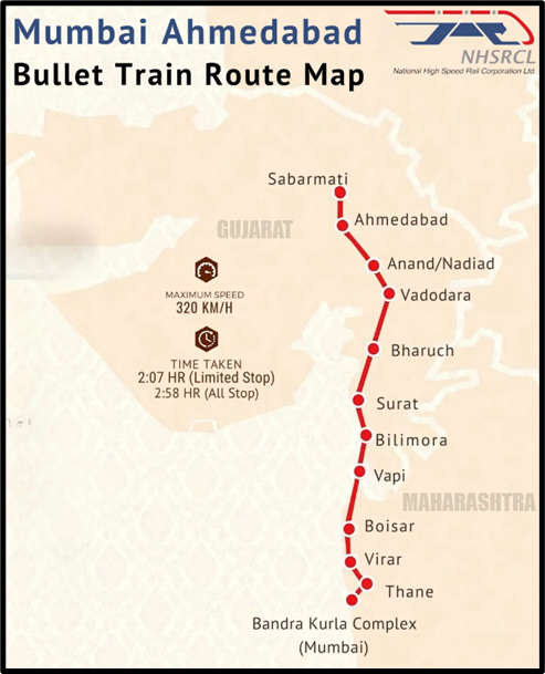
Here’s how spatial analysis comes in:
- Step 1: Points – Mark major industrial hubs, railway stations, and airports on the map.
- Step 2: Connections – Draw possible lines linking these key points. Which routes make sense? Which connect important economic zones?
- Step 3: Direction and Distance – Calculate which route offers optimal direction, minimum distance, and maximum accessibility to boost economic activity.
This analysis helps planners predict the most efficient route, reduce cost, serve more people, and fuel regional development—all by studying spatial arrangement scientifically.
🎯 Why Spatial Analysis Matters in Geography
- It gives geography the power to explain and predict, not just describe.
- It converts maps into tools of scientific inquiry, not just colorful illustrations.
- It shows how space influences society—how proximity, access, and arrangement impact human behavior and decision-making.
🧩 In Summary
| Feature | Description |
|---|---|
| Definition | Quantitative analysis of spatial data (points, lines, areas, surfaces) |
| Origin | Gained traction during the Quantitative Revolution; rooted in Positivism |
| Goal | To build predictive models and spatial generalizations |
| Key Concepts | Direction, Distance, Connection |
| Application | Urban planning, transportation routes, resource management, etc. |