
Twin Cyclones
This section brings us to some of the more advanced and fascinating concepts in cyclone dynamics: twin cyclones, the Fujiwhara effect, hybrid cyclones, and the Madden-Julian Oscillation (MJO). These are not only high-value for UPSC (both Prelims & Mains) but also help you appreciate how global circulation patterns interact with local weather phenomena. Let’s understand this:
Twin Cyclones
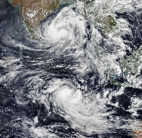
- Definition: When two tropical cyclones form on opposite sides of the equator at roughly the same time, they are called twin cyclones.
- Example: May 2022 → Cyclone Asani (Northern Hemisphere, counter-clockwise spin) and Cyclone Karim (Southern Hemisphere, clockwise spin).
👉 Why opposite spins?
Because of the Coriolis effect:
- Northern Hemisphere → counter-clockwise circulation.
- Southern Hemisphere → clockwise circulation.
What causes twin cyclones?
- The Madden-Julian Oscillation (MJO) and Rossby waves together create enhanced convection across the equatorial region, giving rise to paired storms.
🌪️ Fujiwhara Effect
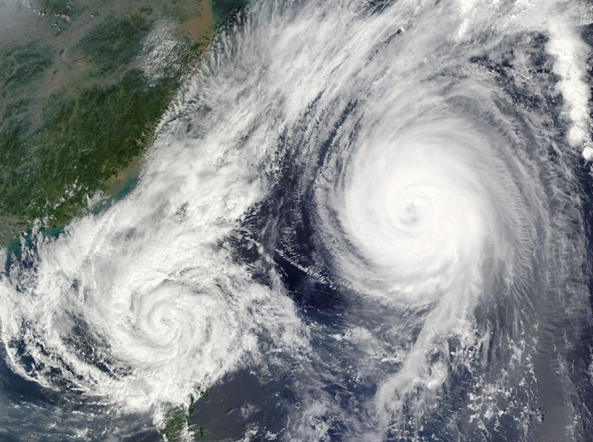
- Sometimes, two cyclones form close to each other in the same hemisphere.
- In such cases, they begin to orbit around a common centre, like a cosmic dance.
- Outcomes:
- They may merge into one stronger cyclone.
- Or, they may deflect each other and move away on separate tracks.
👉 This interaction is called the Fujiwhara Effect (named after Japanese meteorologist Sakuhei Fujiwhara).
🌪️ Hybrid Cyclones
- These are rare systems that combine features of both:
- Tropical cyclones (thermal origin, warm-core).
- Extratropical cyclones (frontal systems, cold-core).
- Example: They may start as tropical cyclones but interact with mid-latitude westerlies, acquiring extratropical traits.
👉 Hybrid cyclones remind us that nature does not follow rigid boundaries; systems can blend characteristics.
Madden-Julian Oscillation (MJO)
This is the key background player in many global weather changes, including cyclone formation.
What is MJO?
- An eastward-moving pulse of convection (thunderstorms) across the tropics.
- Recurs every 30–60 days.
- Difference from ENSO:
- ENSO (El Niño–La Niña) is stationary and lasts for seasons (3–7 years).
- MJO is moving and short-term (week-to-week).
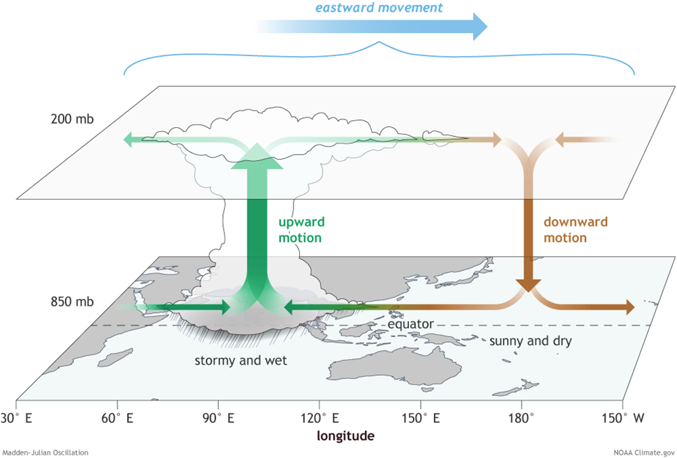
Structure of MJO
- Two phases:
- Enhanced convective phase → Heavy rainfall, deep convection.
- Suppressed convective phase → Reduced rainfall, clear skies.
- The dipole (wet vs dry) keeps propagating eastward between 30°N and 30°S.
🌦️ Impacts of MJO on Weather
- Monsoons: Modulates onset, strength, and withdrawal of monsoons in India.
- Tropical Cyclones: Influences the number and intensity of cyclones across almost all ocean basins.
- Extreme Events: Can trigger jet stream changes, leading to cold waves, heatwaves, or floods in regions like North America.
🌪️ How MJO Helps Twin Cyclone Formation
- The enhanced phase of MJO brings strong thunderstorms → provides the moisture and convection needed for cyclone birth.
- MJO circulation also intensifies rotation.
👉 Mechanism:
- Normally, in the tropics, trade winds blow from the east.
- Behind the MJO, air is drawn inward at low levels → creating low-level westerly winds (called westerly wind bursts).
- These westerlies near the equator interact with easterlies further away → producing enhanced cyclonic rotation on both sides of the equator.
- Result = Twin cyclones spinning in opposite directions simultaneously.